 | Volcanic fields in Utah |
Marysvale volcanic field |
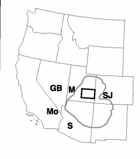
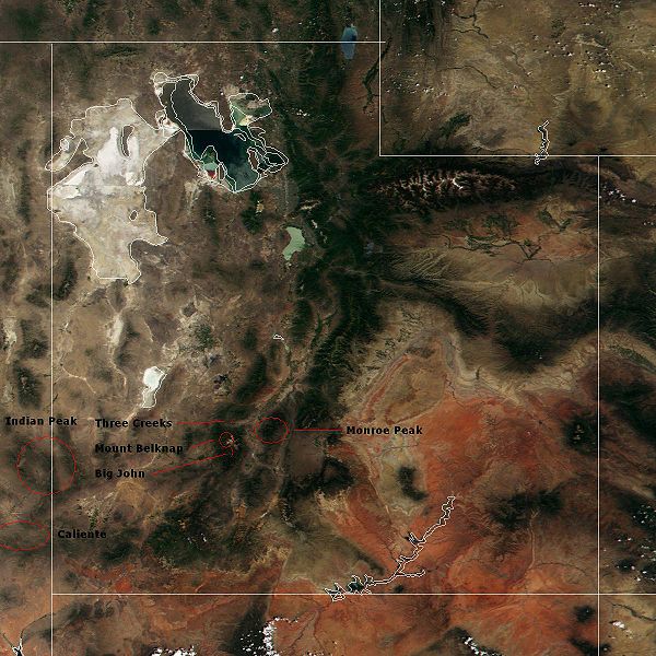
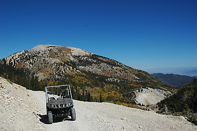
Marysvale volcanic field. The Marysvale volcanic field is located in southwestern Utah, United States.One of the largest volcanic fields in the western United States, the Marysvale straddles the Colorado Plateau-Great Basin transition zone. Most igneous rocks belong to a middle Cenozoic (32 to 22 million years old) calc-alkaline sequence, although about 5% are related to an upper Cenozoic (23 million years to Holocene) bimodal (basalt and rhyolite) sequence. The Marysvale contains a variety of volcanic features, including stratovolcanoes, calderas, lava domes, and cinder cones.The field is an example of intraplate volcanism; its earlier deposits are thought to be related to Farallon plate subduction, while the later bimodal assemblage (especially the basalts) have been linked to Basin and Range extension.Monroe Peak Caldera 23 MA, 20 x 16 km,B&R, Big John Caldera, 10x6, 24 MA, Mount Belknap Caldera 17x13, 19 MA - http://en.wikipedia.org/wiki/Marysvale_volcanic_field |
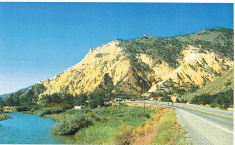
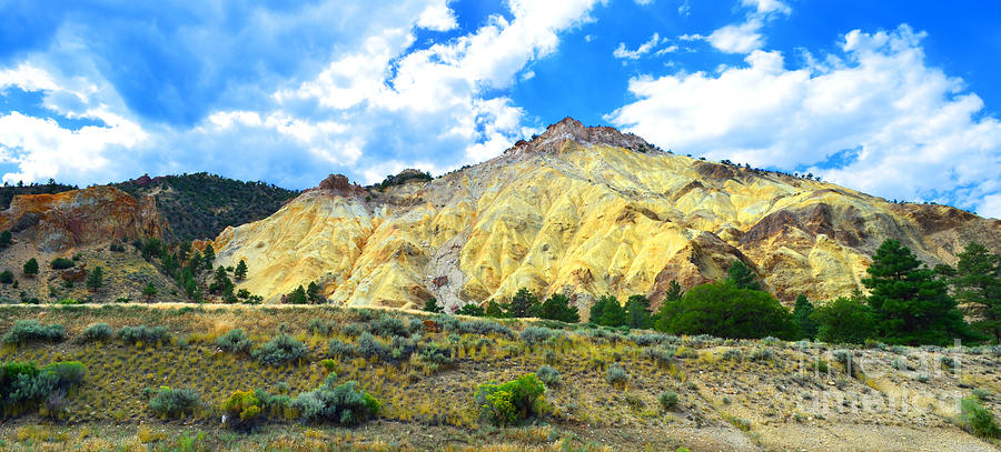
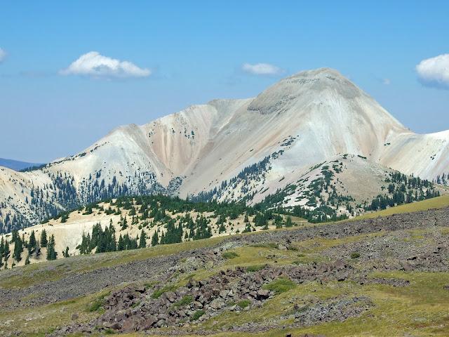
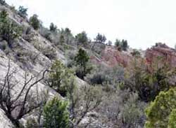
View southward of the hydrothermally altered rocks at Big Rock Candy |
Big Rock Candy Mountain consists of altered volcanic rock in various shades of yellow, orange, red, and white. Approximately 22 to 35 MA, a cluster of stratovolcanoes erupted, depositing large volumes of lava and ash. Known as the Bullion Canyon Volcanics, these volcanic rocks are more than 1,000 km thick.Approximately 21 MA, at least six magma bodies intruded the overlying Bullion Canyon Volcanics. Through a complex chemical process involving hydrogen sulfide, steam, ground water, and oxygen, the original volcanic rock was partially altered or totally replaced. The vivid colors that one sees at Big Rock Candy Mountain are the direct result of this mineralization.The yellow, orange, and red colors are from the presence of iron minerals, such as jarosite, hematite, and pyrite. The white color is due to the presence of alunite and kaolinite, minerals rich in potassium. http://geology.utah.gov/surveynotes/geosights/candymtn.htm |
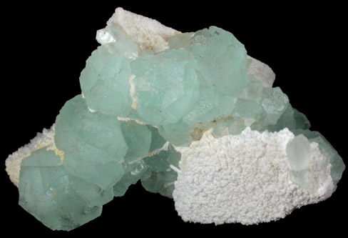
Fluorite from Deer Trail Mine, Deer Trail Mountain-Alunite Ridge mining area, Marysvale volcanic field, near Marysvale, Piute County, Utah |
Mt Belknap. This is the Belknap Caldera |
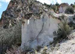
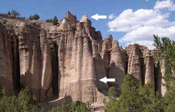
Castle Rock. 19 MA. Lava flows, debris flows, and volcanic ash falls that accumulated during this time are more than a 1.6 km thickThe light-colored Joe Lott Tuff erupted 19 million years ago within the Marysvale volcanic field -http://geology.utah.gov/surveynotes/geosights/castlerock.htm |
Castle Rock .The Joe Lott Tuff contains fragments of gray pumice and other darker volcanic rocks |
So much material was ejected during the eruption that the roof of the magma chamber collapsed due to the loss of interior support, creating the Mount Belknap caldera, located about 10 miles to the southwest |
Castle Rock .Not long after this eruption (geologically speaking, 1 or 2 million years), the EarthÆs crust here and to the west began to be stretched westward. During this initial phase of basin-range extension, sediments were eroded off higher areas and deposited in river channels, flood plains, and lakes, eventually filling in valleys and canyons with layers of siltstone, mudstone, sandstone, and conglomerate. This deposition occurred between 14 and 5 million years ago and produced what is now called the Sevier River Formation - http://geology.utah.gov/surveynotes/geosights/castlerock.htm., |
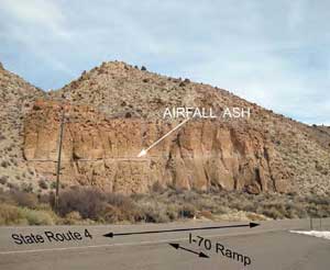
Castle Rock. The two white layers within the Sevier River Formation, near the bottom and the top, are airfall volcanic ash deposits |
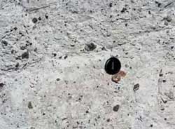
An airfall volcanic ash layer is exposed in this outcrop of the pink unit of the Joe Lott Tuff along State Route 4 near I-70 exit 17. Oldest rock unit at the park is the 19-My Joe Lott Tuff in Clear Creek Canyon. The rock is a welded volcanic-ash avalanche deposit containing scattered pieces of rhyolite lava (ash-flow tuff) that was produced by an explosive volcanic eruption. The massive eruption created the Mount Belknap caldera located about 15 km south of Clear Creek Canyon. The tuff is exposed in the high cliffs in the canyon. The surface of the originally white, pink, and gray tuff has weathered to darker colors and serves as a ōblackboardö for Fremont Indian rock art. http://geology.utah.gov/surveynotes/geosights/fremont_state_park.htm |
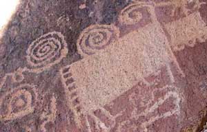
Fremont Indian petroglyphs pecked into the Joe Lott Tuff. The dark surface was produced by weathering of the lighter colored tuff. (Photo courtesy of Fremont Indian State Park)., an airfall volcanic ash layer is exposed in this outcrop of the pink unit of the Joe Lott Tuff along State Route 4 near I-70 exit 17. Oldest rock unit at the park is the 19-My Joe Lott Tuff in Clear Creek Canyon. The rock is a welded volcanic-ash avalanche deposit containing scattered pieces of rhyolite lava (ash-flow tuff) that was produced by an explosive volcanic eruption. The massive eruption created the Mount Belknap caldera located about 15 km south of Clear Creek Canyon. The tuff is exposed in the high cliffs in the canyon. The surface of the originally white, pink, and gray tuff has weathered to darker colors and serves as a ōblackboardö for Fremont Indian rock art. http://geology.utah.gov/surveynotes/geosights/fremont_state_park.htm |
Big John Caldera |
GEOLOGY AND MINERAL RESOURCES OF THE MARYSVALE VOLCANIC FIELD
Geological map
Large_volume_volcanic eruptions in the Basin and Range Province
Great Basin section