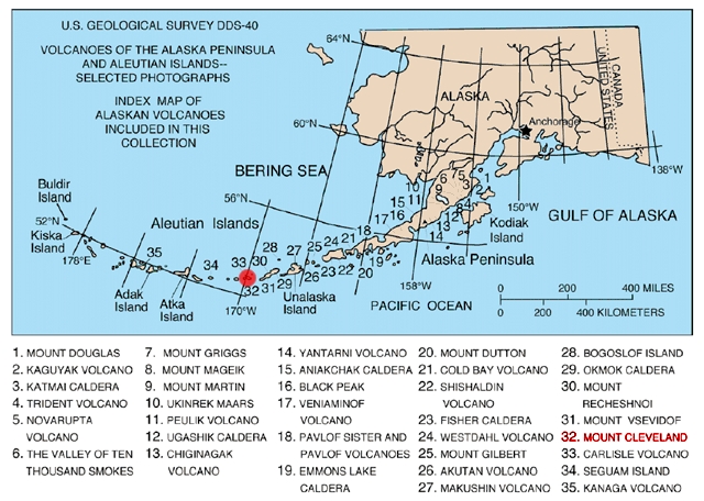
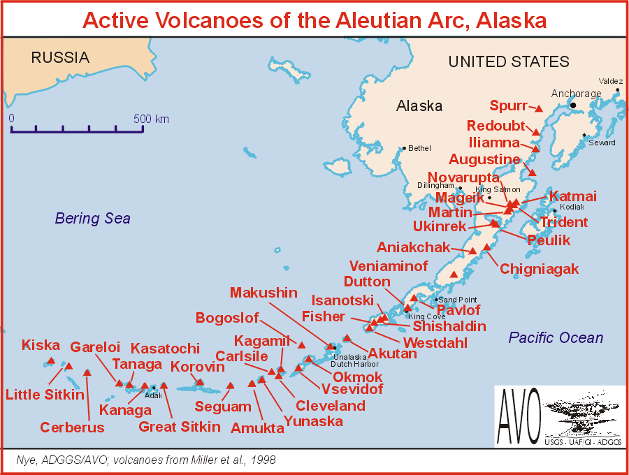
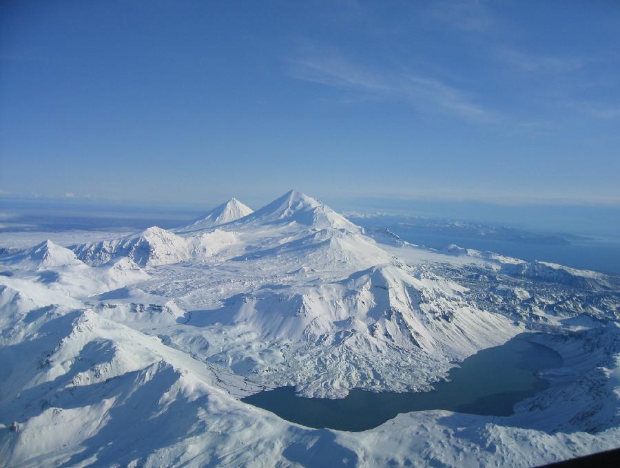
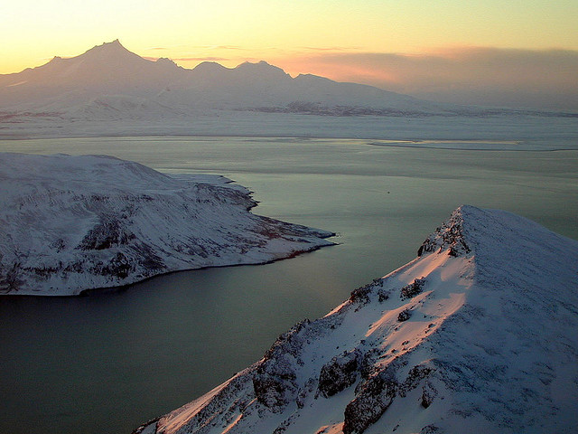
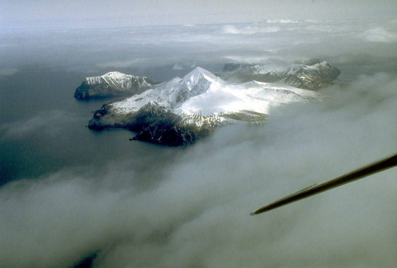
 | Aleutian Range, Aleutian Arc |
|
|
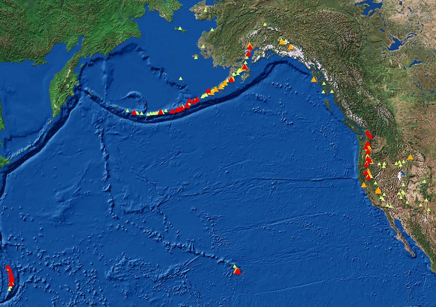
U.S. Volcanoes and NVEWS Targets: red 35 highest, priority volcanoes, orange 22 high-priority volcanoes, small green the other U.S. volcanoes -http://volcanoes.usgs.gov/publications/2009/nvews.php |
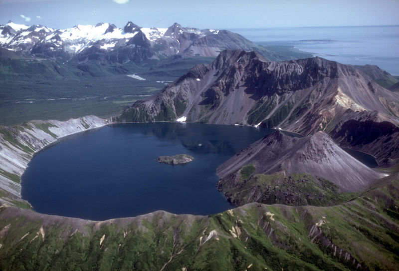
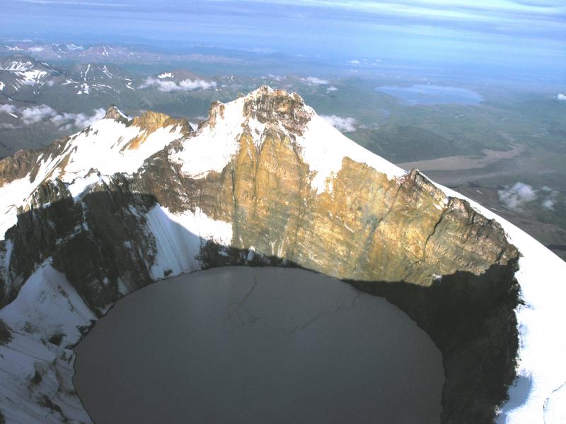
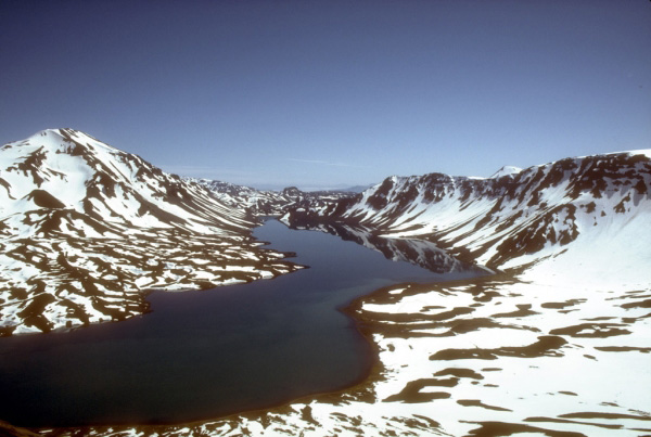
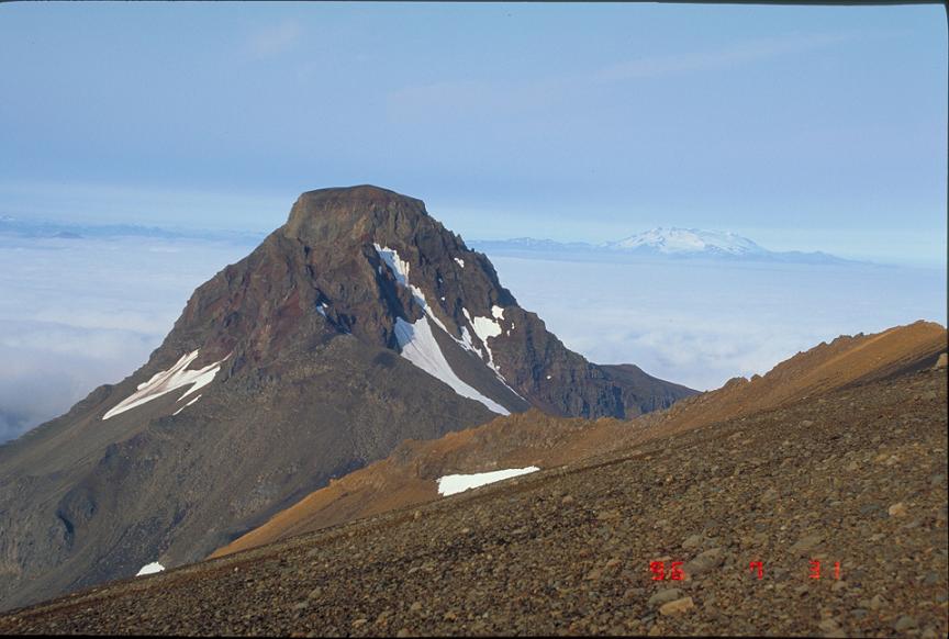
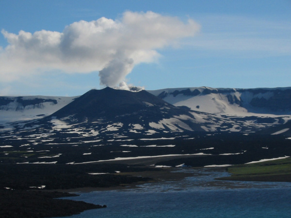
Lake filled caldera of Kaguyak. Mount Kaguyak , 901 m, Aleutian Range, Aleutian Arc,is a stratovolcano located in the northeastern part of the Katmai National Park in Alaska. The 2.5 km wide caldera is filled by a more than 180 m deep crater lake. The surface of the crater lake lies about 550 m below the rim of the caldera. Postcaldera lava domes form a prominent peninsula in the center of the lake. Even though the volcano is only 901 m high it is spectacular, because it rises from lowland areas near sea level in the south of the Big River. Based on radiocarbon dating the caldera-forming eruption occurred about 5800 years before present. During this eruption at least 120 square kilometers were covered in a dacitic ignimbrite - http://en.wikipedia.org/wiki/Mount_Kaguyak |
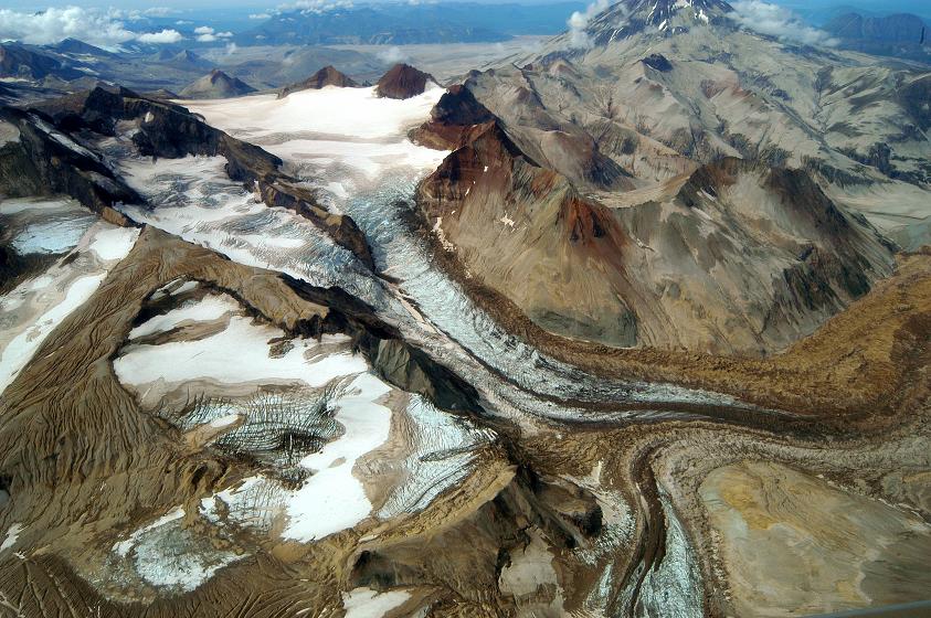
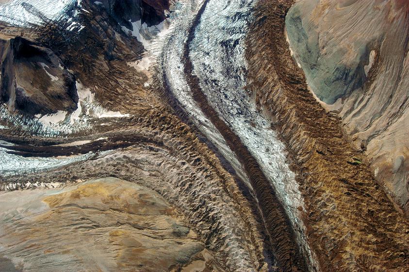
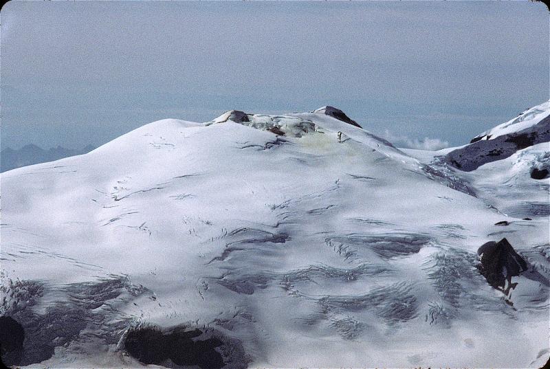
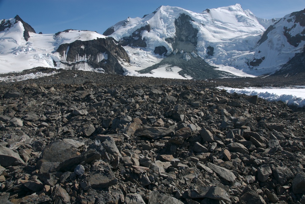
Ash covered glacier on spope of Mt. Katmai |
Ash covered glacier on spope of Mt. Katmai |
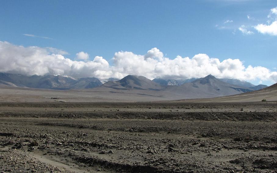
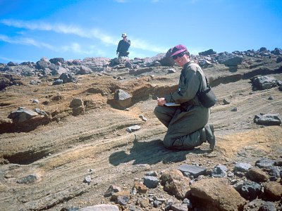
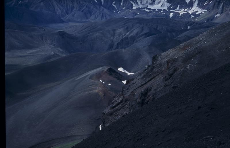
Baked and Broken Mtns |
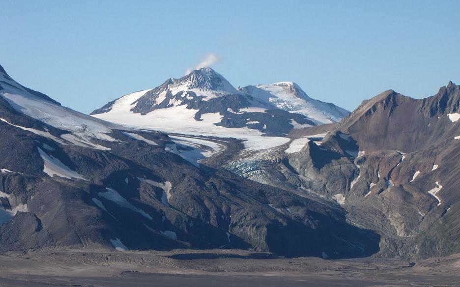
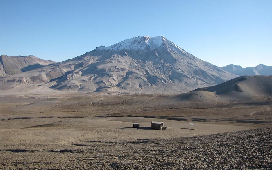
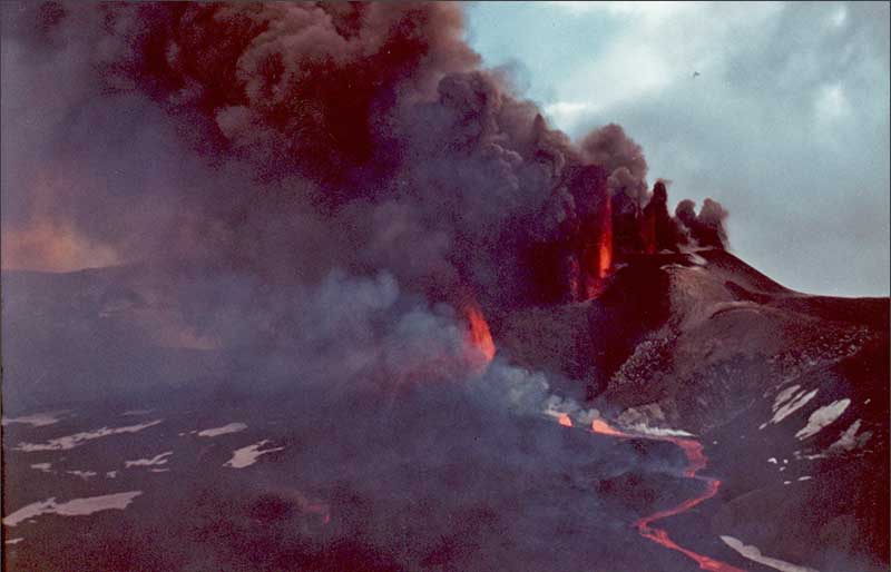
Mount Martin is a stratovolcano - http://www.watchingforrocks.com/2010/09/novarupta-and-night-sky-stars.html |
Mount Martin |
Mount Martin |
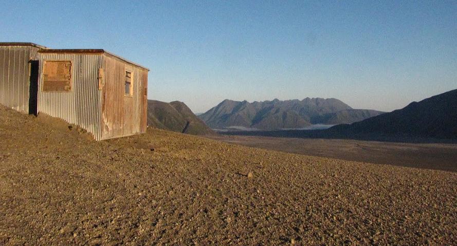
the USGS research Hut on Baked Mtn |
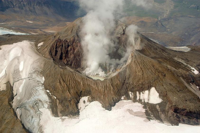
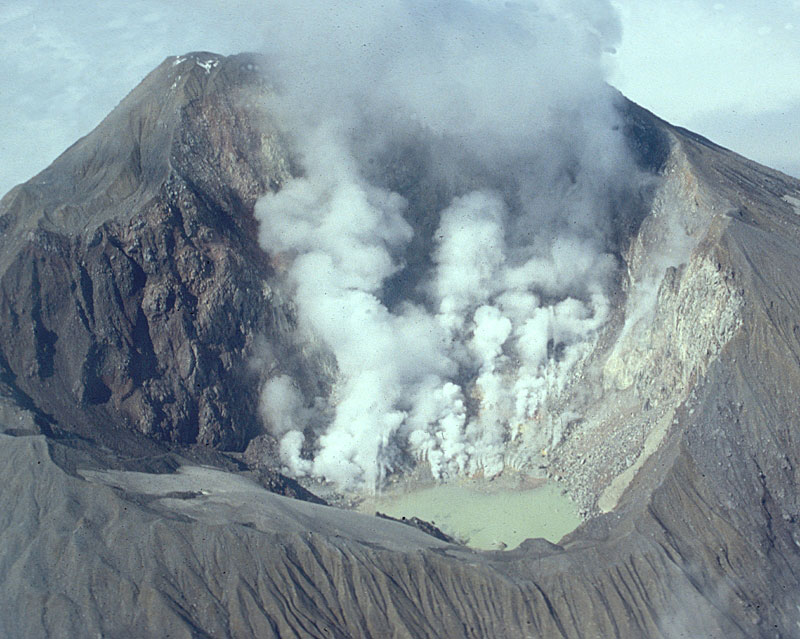
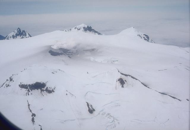
Griggs volcano contains three nested summit craters, two of which are on top of a Holocene central cone. Mt Griggs volcano is better preserved than many stratovolcanoes in the region.Fumaroles are present in the summit crater and SW flank. A dacite scoria flow at base of Mount Griggs originated from Katmai volcano.Pyroclastic flow deposits. Three glacially eroded remnants of pyroclastic flow deposit are located at the southern base of Griggs volcano in upper Knife Creek. The flow is up to 10 m think, and consists of scoria lapilli mostly 1-2 cm diameter.Basaltic scoria fall. A scoria fall outcrop ,1 m thick, 5 m across, and 25 m long, is located at the southern base of Griggs volcano. The pumice originated from Katmai volcano.Griggs Volcano Eruptions - 3460 years ago.http://www.volcanolive.com/griggs.html |
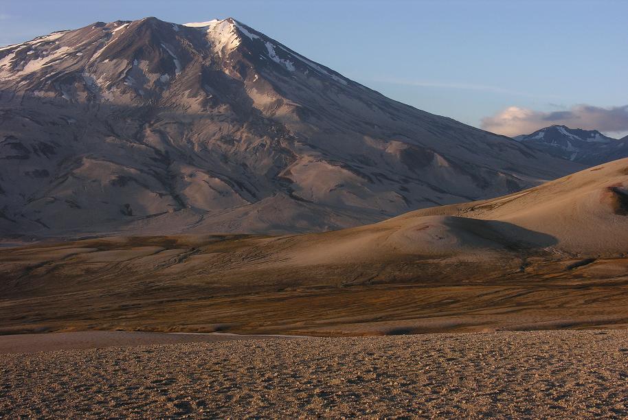
Griggs And Hut. |
Mount Griggs,2317m, formerly known as Knife Peak Volcano, is a stratovolcano, which lies 10 km behind the volcanic arc defined by other Katmai group volcanoes. Although no historic eruptions have been reported from Mount Griggs, vigorously active fumaroles persist in a summit crater and along the upper southwest flank. The fumaroles on the southwest flank are the hottest, and some of the flank fumaroles can roar so loudly that they can be heard from the valley floor. The slopes of Mount Griggs are heavily mantled by fallout from the 1912 eruption of Novarupta volcano. NW view from west rim of Katmai caldera, July - http://en.wikipedia.org/wiki/Mount_Griggs |
Fumarolic activity at Kukak volcano in August 2003, Mount Kukak, 2045 m, is an almost completely ice-covered stratovolcano on the Alaska Peninsula of Alaska, United States. Although the last eruption from Mount Kukak is unknown, it displays vigorous fumarolic activity - http://en.wikipedia.org/wiki/Mount_Kukak |
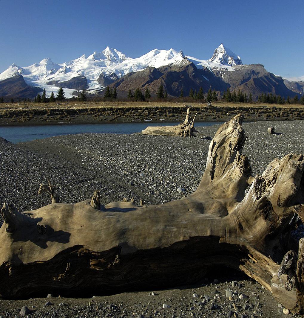
Mt Steller, Kukak Volcano, and Devils Desk. Mount Steller , 2,272 m, is a stratovolcano in Katmai National Park in Alaska, United States. It is part of the Aleutian Range and is located on the Alaska Peninsula.Mount Steller is part of a chain of closely spaced NE-SW-trending vents in Katmai National Park and lies between Mount Denision and Kukak volcanoes. Uncertainty surrounds the number and location of volcanic vents in this heavily glaciated area. The precise age of the most recent activity at Steller volcano is not known, but the volcano was considered to have been active during the Holocene (Nye et al., 1998). http://www.avo.alaska.edu/volcanoes/volcinfo.php?volcname=Steller http://www.nps.gov/katm/planyourvisit/Katmai-Volcanoes.htm |
Mt. Steller |
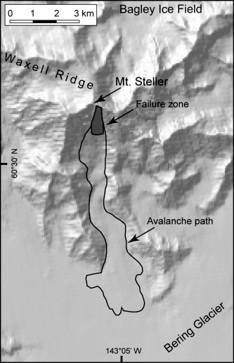
Mt Steller Landslide |
These photos were taken on July 14, 2008. The landslide had happened recently.The center of the runout on the glacier is located at about 60.56 N 142.99 W. There are some very interesting snow push features, which gave the impression that the slide was traveling slowly at the end of the event. Also, we did not see much if any dust on the snow - http://fairweather.alaska.edu/chris/images/Steller_slide_24July2008/index.html |
higinagak volcano -http://en.wikipedia.org/wiki/Mount_Chiginagak |
higinagak volcano''s crater lake as viewed from the east. Mother Goose Lake can be seen to the northwest or top right of the photo |
Chiginagak Volcano and Mother Goose Lake |
Yantarni Volcano is an andesitic stratovolcano in the U.S. state of Alaska. It is located on the Alaska Peninsula, in the Aleutian Range. It is between Mount Aniakchak and Chiginadak volcanoes. The volcano was not discovered until 1979 due to its remote location, lack of documented historic activity and its rather modest summit elevation. The mountain was named after nearby Yantarni Bay which in turn was named by Russian explorers after the abundance of yantar in the area. The current cycle of eruptive activity began in middle Pleistocene time with extrusion of andesitic lava flows, perhaps from multiple vents. By the late Pleistocene, central-vent volcanism had initiated construction of a small stratovolcano. The cone was breached sometime in the late Holocene, between 2 and 3.5 ka, during the only Holocene event. The eruption was similar to that of Mount St. Helens. and was followed by the emplacement of 1 km3 of pyroclastic flows related to growth of the summit lava dome. It had a VEI=5 . Last eruption 800 BCE +/- 500 years http://en.wikipedia.org/wiki/Yantarni_Volcano |
Black Peak , 1,032 m, is a highly eroded stratovolcano comprising a lava dome complex on the Alaska Peninsula of the U.S. state of Alaska. Also called Black Volcano or Sopka Chornaia, the mountain is located within the Lake and Peninsula Borough.The latest eruption from Black Peak less than 4,000 years ago produced an explosive eruption with a Volcanic Explosivity Index of 6 that created a caldera. Ash flow tuffs and block-and-ash-flow deposits from this explosive eruption traveled down the Ash Creek and Bluff Creek valleys that reach depths of 100 m (328 ft). Last eruption 1900 +/-150 years - http://en.wikipedia.org/wiki/Black_Peak |
|
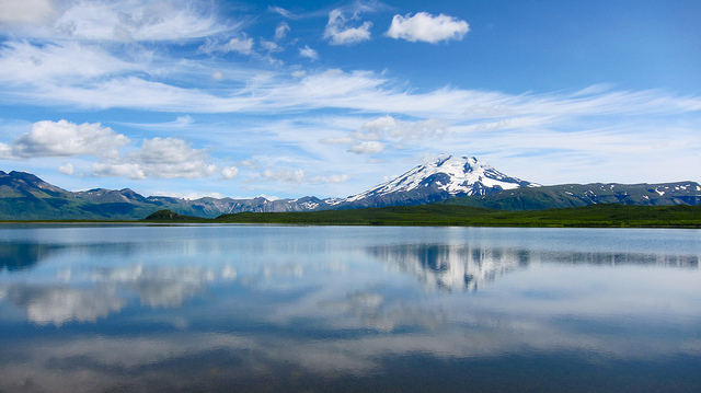
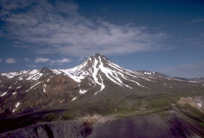
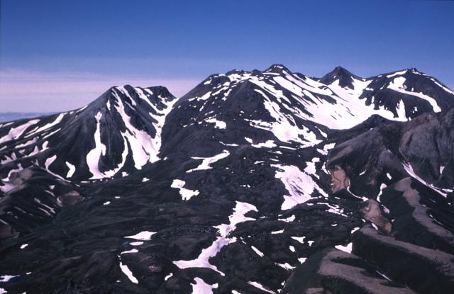
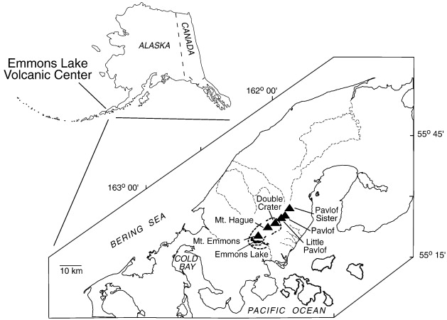
View, looking northeast, of 1,436-m -high Mount Emmons, a postcaldera stratovolcano within the Emmons Lake caldera on the Alaska Peninsula. The most recent of several caldera-forming eruptions at Emmons Lake. In order going NE are Emmons Lake, Mt Emmons, Hague, Double Crater, Little Pavlof, Pavlof, and Pavlof''s Sister. Volcanoes: Double Crater, Emmons Lake Caldera, Emmons Lake Volcanic Center, Emmons, Mt, Hague, Mt, Little Pavlof, Pavlof, Pavlof Sister Mount Emmons, 1,436 m is a post-caldera stratovolcano within the Emmons Lake caldera on the Alaska Peninsula. It is one of three cones constructed within the 711 x 18 km caldera, which also contains an elongated crater lake on its southwest side.The most recent of several caldera-forming eruptions at Emmons Lake occurred more than 10, KA. No historical eruptions have occurred at Emmons Lake. Photographer Hazen Ryan, http://www.avo.alaska.edu/images/image.php?id=16224 http://en.wikipedia.org/wiki/Mount_Emmons_(Alaska) |
The Emmons Lake volcanic center is the site of a large stratovolcano with a pre-caldera volume of 300-400 km3 and one of the largest calderas in the Aleutian arc. The center is very complex; at least two large caldera-forming eruptions have occurred in Late Quaternary time, and voluminous post-caldera volcanism continues to the present. The entire area has been subjected to multiple glaciations, and ice fields present occur in the caldera. A small lake in the southwest corner of the caldera drains to the Pacific Ocean through a breach in the southeast rim of the caldera. The pre-caldera Emmons Lake volcano was built on the northeast flank of a topographic basement high composed of Tertiary volcanogenic and intrusive rocks that are exposed at an elevation of over 900 m in the caldera wall west of Emmons Lake. This period of volcanism consisted of an outpouring of andesitic basalt and volcaniclastic rocks over an area of 700 square km or more. Following deep erosion and glaciation, a major caldera-forming eruption occurred, resulting in the deposition of welded ash-flow tuffs of rhyolitic composition on both the Bering Sea and Pacific Ocean flanks of the volcano. In some cases, these welded tuffs filled deep valleys in the pre-caldera cone. At least some post-caldera basaltic volcanism appears to have occurred at this time, principally associated with Mount Emmons.A second caldera-forming eruption, probably in late Wisconsin time, resulted in the emplacement of non-welded rhyolitic ash-flow tuffs in all quadrants around the volcano to distances >30 km from the caldera rim. Renewed post-caldera volcanism appears to have been chiefly basaltic in character. Within the caldera this activity has been characterized by aa and block lava flows emitted from several small cinder cones and vents. Some of the young Holocene flows moved through the breach in the southern caldera wall and are found within a kilometer of the Pacific Ocean. A large fumarolic area occurs on the south side of Mount Hague, which is near the eastern margin of the caldera.http://www.avo.alaska.edu/volcanoes/volcinfo.php?volcname=emmons%20lake%20volcanic%20center |
Cold Bay Volcano |
Mount Gilbert, 818, is a volcano which forms the northern part of Akun Island in the eastern Aleutian Islands, USA. Active fumaroles were documented 1.5 km northeast of the summit in the early 1900s- http://en.wikipedia.org/wiki/Mount_Gilbert_(Alaska) |
Mount Gilbert is a small extinct volcano on northernmost Akun Island. Its northern flank is steep and heavily eroded, presumably by the sea, while its southern flank is little dissected. The summit region has been completely eroded and was presumably north of, and higher than, the present summit. A 20,000 m2 zone of slightly older fumarolically altered rock exists 1.5 km northeast of the current summit. Prior to 1948, active fumaroles in this area produced steam plumes visible from a distance; fumarolic activity has since stopped. The altered ground was the site of an unsuccessful attempt to mine sulfur in the 1920''s http://www.avo.alaska.edu/images/image.php?id=2531 |
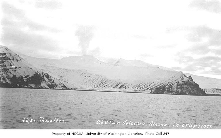
Mount Akutan, 1303 m, officially Akutan Peak, is a stratovolcano in the Aleutian Islands of Alaska. Akutan Peak, is the highest point on the caldera of the Akutan stratovolcano. Akutan contains a 2 km-wide caldera formed during a major explosive eruption about 1600 years ago. Recent eruptive activity has originated from a large cinder cone on the NE part of the caldera. It has been the source of frequent explosive eruptions with occasional lava effusion that blankets the caldera floor. A lava flow in 1978 traveled through a narrow breach in the north caldera rim to within 2 km of the coast. A small lake occupies part of the caldera floor. Two volcanic centers are located on the NW flank: Lava Peak is of Pleistocene age; and, a cinder cone lower on the flank which produced a lava flow in 1852 that extended the shoreline of the island and forms Lava Point. An older, mostly buried caldera seems to have formed in Pleistocene or Holocene time, while the current caldera formed in a VEI-5 eruption. The volcano erupted most recently in 1992, but there is still fumarolic activity at the base of Lava Point and there are hot springs North-East of the caldera . Last eruption 1992. http://en.wikipedia.org/wiki/Mount_Akutan |
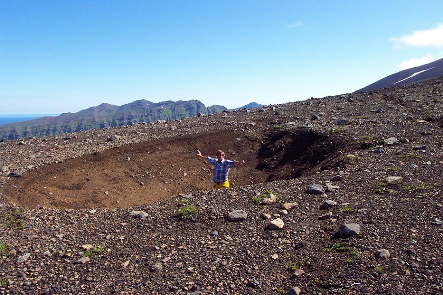
Photograph showing a small graben west of the summit of Akutan Volcano. Note unconsolidated surficial material and sparse vegetation. Photograph by John Power, USGS, August 2001 - http://volcanoes.usgs.gov/activity/methods/insar/fact_sheet_figures.html |
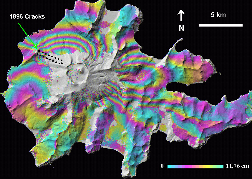
Interferogram showing deformation of Akutan Island (October 1994 to June 1997), draped over shaded-relief map of the island. Based on Japanese Earth Resources Satellite imagery (L-band radar). From Lu and others, 2005 -http://volcanoes.usgs.gov/activity/methods/insar/fact_sheet_figures.html |
|
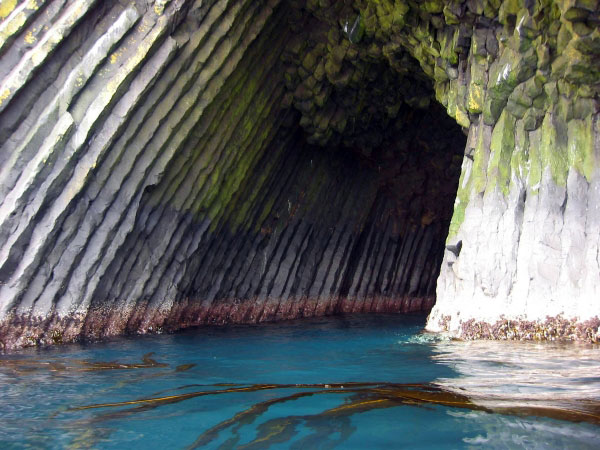
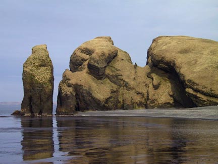
Volcanic debris deposited in past eruptions of Akutan Volcano is sculpted into fantastic shapes by wind and waves -http://wolfgangbrinck.com/boats/baidarka/akutan/views.html |
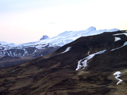
The rim of Akutan volcano''s caldera is visible against the sky. Akutan owes its existence to the volcano which is still active and has erupted as recently as a few decades ago |
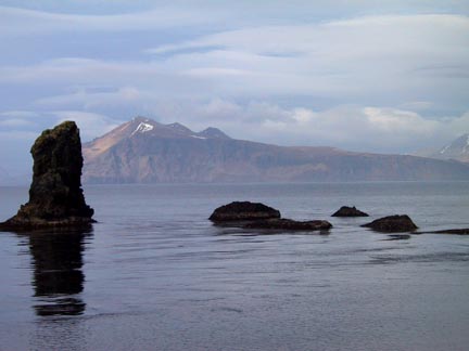
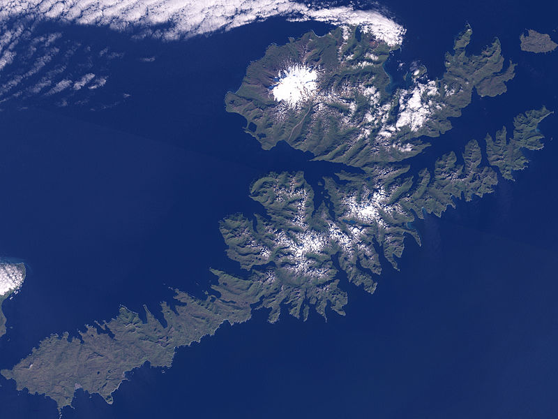
At the east end of Akutan, the island of Akun |
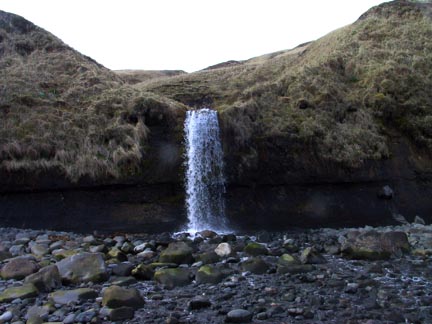
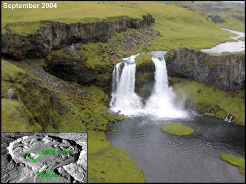
one of the many waterfalls on the island. |
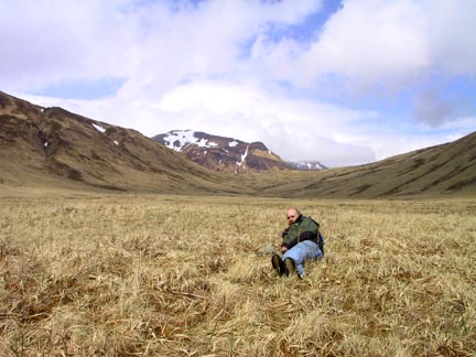
Akutan,the tundra |
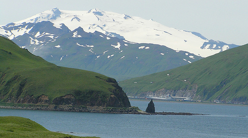
Unalaska Island, Makushkin Volcano, photo NACA.The Makushin Volcano is an ice-covered stratovolcano located on Unalaska Island in the Aleutian Islands. With an elevation of 2,036 m its summit is the highest point on the island. Makushin is one of the most active among the 40 volcanoes of Alaska. It has erupted at least two dozen times over the past several thousand years, with the last eruption occurring in 1995. In 1792, Sarichev called the volcano "Ognedyshushchaya Gora" meaning "fire erupting mountain". In 1825, it was known as Makuschkin Volcano, possibly from the Russian word makushka. Specifically identified here are the four features namely, Red Cinder Dome, Pakushin cone, the Sugarloaf and the Point Kadin vents. The history of the volcano has been identified with the early Pliocene age. However, the caldera of the volcano is dated to a comparatively recent history of 8000 years. The Sugarloaf cone on the ENE flank, and a cluster of about a dozen explosion pits and cinder cones at Point Kadin on the WNW flank is attributed to the Holocene age. The first episode began in Pliocene or early Pleistocene time (the oldest known age of lavas is 0.93 Ma [Nye, 1990] and produced extensive flows and subordinate pyroclastic deposits of basaltic and andesitic composition, which enlarged the island by several kilometers along the northwest coast. Radial dips of flows suggest that Makushin Volcano itself was the principal vent area. The older flows are extensively glaciated, which implies a minimum age of late Pleistocene. The summit of Makushin subsequently collapsed, forming a caldera. Andesitic pyroclastic-flow and debris flow deposits occur in glaciated valleys on the north and south sides of the volcano indicating a Holocene age for the caldera-forming eruption." http://en.wikipedia.org/wiki/Makushin_Volcano |
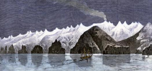
Sailing Ship Near Makushin Volcano on Unalaska Island in the Aleutians, 1870, http://www.art.com/products/p14383973-sa-i3032469/sailing-ship-near-makushin-volcano-on-unalaska-island-in-the-aleutians-1870.htm.John Muir, the Scottish-born American naturalist (18381914), in his book "The Cruise of the Corwin (1881)", has vividly described this volcano: The noblest of them all was Makushin, about nine thousand feet high and laden with glaciers, a grand sight, far surpassing what I had been led to expect. There is a spot on its summit which is said to smoke, probably mostly steam and vapor from the infiltration of water into the heated cavities of the old volcano. The extreme summit of Makushin was wrapped in white clouds, and from beneath these the glaciers were seen descending impressively into the sunshine to within a thousand or fifteen hundred feet of sea-level. This fine mountain, glittering in its showy mail of snow and ice, together with a hundred other peaks dipping into the blue sky, and every one of them telling the work of ice or fire in their forms and sculpturethese, and the sparkling sea, and long inreaching fiords, are a noble picture to add to the thousand others which have enriched our lives this summer in the great Northland |
Historically, Makushin is one of the most active volcanoes in the Aleutian Islands, erupting at least two dozen times over the past several thousands years, the last in 1995. Seventeen explosions or eruptions of the Makushin Volcano have been recorded since 1786, though the magnitude has been termed as small-to-moderate. These were recorded in the years 176869, 1790?, 1792?, 1802, 1818?, 182638?, 1844?, 1865, 1867?, 1883, 1907, 1912?, 1926, 1938, 1951, 1952?, 1980, 1987 and 1995. Makushins pinnacle last erupted on January 30, 1995, which generated ash extending to an altitude of 2.5 km. In the 1987 eruption, which occurred on March 2, the plume rose to 900 m above the volcano. The 1980 eruption was comparatively of smaller magnitude emanating from a vent on the southern side about 60 m below the volcanic peak. Although the volcano has not erupted since 1995, studies conducted between July 1996 and August 2000 recorded some 176 minor earthquakes registering between 0.1 and 3.2 on the Richter Scale, occurring on average 2 to 3 times a month. The hypocenters of the earthquakes generally occur in two cluster areas, the first is the larger and more active, located about 6 km southeast of the summit of the volcano at depths ranging from 29 km and the second, about 24 km east of the summit under Unalaska Bay occurs at depths of 614 km.The caldera, which crowns the volcano, has a width of 2.5 km is also mentioned in another reference). Compared with the other Aleutian strato-volcanoes in the region, which have steep profiles, the Makushin volcano is a contrast that exhibits a broad and dome like structure with an ice field coverage of 40 km2. Fumaroles and hot springs in area form a roughly linear trend. About 8 km to the south of this volcano is the composite Pakushin cone that has multiple craters, which is 4000 years old eruption; pyroclastic flows and surges have been reported here. The southeast flank of the volcano has rock exposures, at 975 m elevation.The pyroclastic flows deposited by the eruptions forming the Caldera have engulfed valleys in the eastern, northeastern, northern, and western valleys of the valley with depths up to 100 m. The northeast border of the volcano is also filled with volcanic lava, which is called the Lava Ramp spreading to an area of 50 km2. A subsidiary cone formed is the Pakushin Cone), on the south. In the east and southeast part of the volcano hot springs and fumaroles have been created, at the summit and in valleys. A valley of the same name stretches to the northeast of the volcano from Broad Bay in Captain''s Bay and was identified as a glacial valley after a survey in 1873. The terrain surrounding the volcano is very rugged but most of the surface surrounding the volcano is vegetated. However, it is generally less pronounced in the area of pyroclastic flows and deposits. Areas of short and tall grass grow in the volcano area, ranging from less than 20 cm high to over 1 meter. http://en.wikipedia.org/wiki/Makushin_Volcano |
Aerial view of the Point Kadin vents, a series of post- glacial explosion pits and small cinder cones that occur along a fracture zone northwest of the summit of Makushin Volcano.The high-temperature geothermal resources study of volcanoes in Alaska has covered the Geothermal areas in the summit caldera peak and also on the southeastern and eastern flanks of the Makushin. It is recorded as a subduction-related volcanic arc in the middle of the great Aleutian chain. http://en.wikipedia.org/wiki/Makushin_Volcano |
From Miller and others (1998): Makushin volcano is a broad, truncated stratovolcano, 1800 m high and 16 km in basal diameter, which occupies most of the triangular northwest extension of Unalaska Island. A breached summit caldera, about 3 km across, contains a small cinder cone, eroded remnants of other cones, and several fumaroles. The volcano is capped by an icefield of about 40 km3; subsidiary glaciers descend the larger flanking valleys to elevations as low as 305 m. Makushin volcano was constructed during two periods of volcanism separated by an interval of pronounced erosion (Drewes and others, 1961). Bedrock is exposed as high as 975 m on the southeast flank of the volcano. The first episode began in Pliocene or early Pleistocene time (the oldest known age of lavas is 0.93 Ma [Nye, 1990]) and produced extensive flows and subordinate pyroclastic deposits of basaltic and andesitic composition, which enlarged the island by several kilometers along the northwest coast. Radial dips of flows suggest that Makushin Volcano itself was the principal vent area. The older flows are extensively glaciated, which implies a minimum age of late Pleistocene. The summit of Makushin subsequently collapsed, forming a caldera. Andesitic pyroclastic-flow and debris flow deposits occur in glaciated valleys on the north and south sides of the volcano indicating a Holocene age for the caldera-forming eruption (Miller and Smith, 1987). Reeder (1983) reported a C14 age determination of 7950 +/- 90 ypb on organic soil directly beneath the pyroclastic flow deposits and Nye and others (1984) report a limiting C14 age of 4280 +/- 280 ybp on organic material in a debris flow. Several monogenetic satellite vents composed of basaltic and andesitic lava flows, ash, and scoria cones occur within the summit caldera. These vents also form smaller cones on Makushin''s flanks and surrounding area. Most of these vents have been slightly glaciated but blanket late Pleistocene topography indicating a latest Pleistocene or early Holocene age. Pakushin cone, a multiple-cratered composite cone, lies 8 km southwest of Makushin Volcano. Tabletop Mountain, the eroded remains of a pyroclastic cone encircled by flows originating from small flank vents, is 20 km northeast. Wide Bay cone, a small symmetric cone with an oval summit crater, occupies the northwest edge of Unalaska Bay, and Sugarloaf cone, built of steeply dipping, crudely bedded pyroclastics, is situated 14 km to the southwest. The Point Kadin vents, 10 small cones and explosion craters aligned along a rift zone trending N75W from the summit caldera, lie just south of an ash-flow deposit which fills a valley extending north from the volcano to the coast. The deposit is relatively undissected and may correlate with a blanket of airfall ash and cinders that covers part of the icefield on the volcano''s northern flank. Based on geomorphic analysis, Arce (1983) infers that the sequence of Holocene events to have been as follows: construction of Sugarloaf cone, activity at Tabletop Mountain, construction of Makushin cone, and lastly, construction of the Wide Bay cone and activity on the Pt. Kadin vents. Arce (1983) concludes that at least 15 tephra layers of Holocene age are recognizable on northern Unalaska Island; however, he assigns some to satellite vents of Makushin Volcano and others to more distant sources, so the exact number of deposits attributable to Makushin Volcano is uncertain." http://www.avo.alaska.edu/volcanoes/volcinfo.php?volcname=Makushin |
Photo of large coastal outcrops of many layered lava flows from Makushin Volcano on Unalaska Island, AK. The larger lens shaped layer is likely a sill.- http://www.avo.alaska.edu/volcanoes/volcinfo.php?volcname=Makushin |
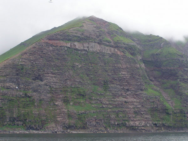
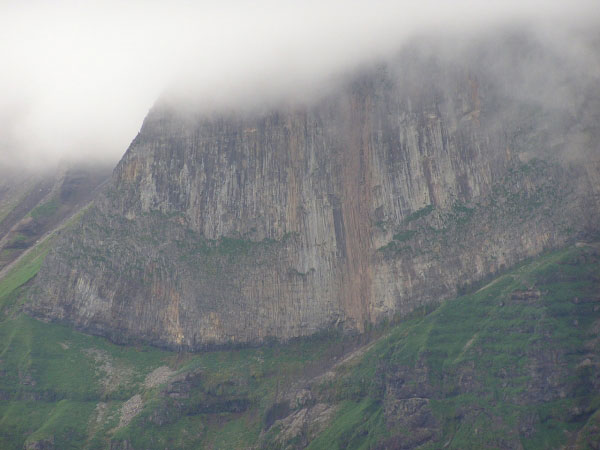
Photo of a massive coastal outcrop of lava flows from Makushin Volcano on Unalaska Island, AK. Long columnar joints can be observed from the base of the section extending up into the clouds. Layering of the lava flows is also visible at the base and upper part of the section-http://www.avo.alaska.edu/volcanoes/volcinfo.php?volcname=Makushin |
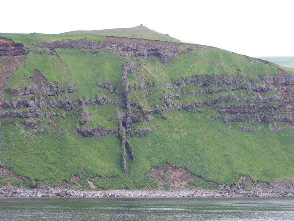
Photo of coastal outcrops of lava flows from Makushin Volcano on Unalaska Island, AK. Exposed portions of vertical dikes of lava cut the layers of lava in this section- http://www.avo.alaska.edu/volcanoes/volcinfo.php?volcname=Makushin |
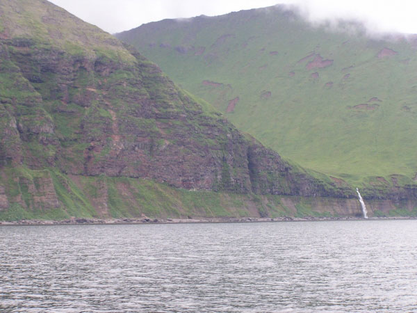
Photo of large coastal outcrops of layered lava flows from Makushin Volcano on Unalaska Island, AK. A waterfall on the right side flows from the hanging valley that had been rounded by glaciers - http://www.avo.alaska.edu/volcanoes/volcinfo.php?volcname=Makushin |
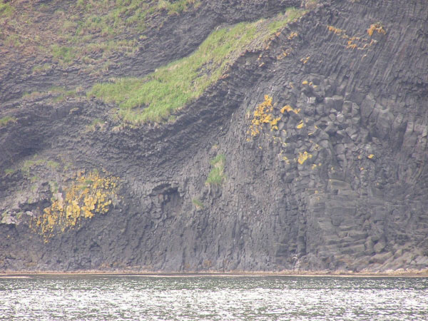
Photo of columnar jointing within large coastal outcrops of lava flows from Makushin Volcano on Unalaska Island, AK - http://www.avo.alaska.edu/volcanoes/volcinfo.php?volcname=Makushin |
Umnak Island, Mount Okmok |
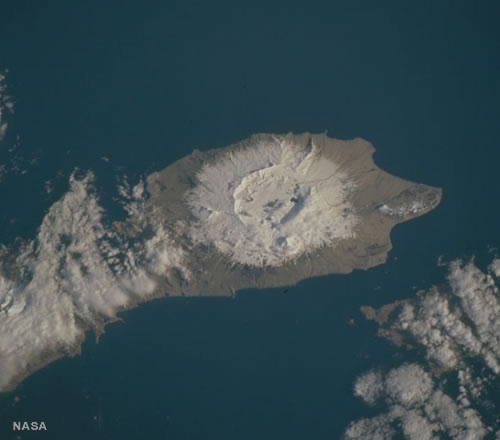
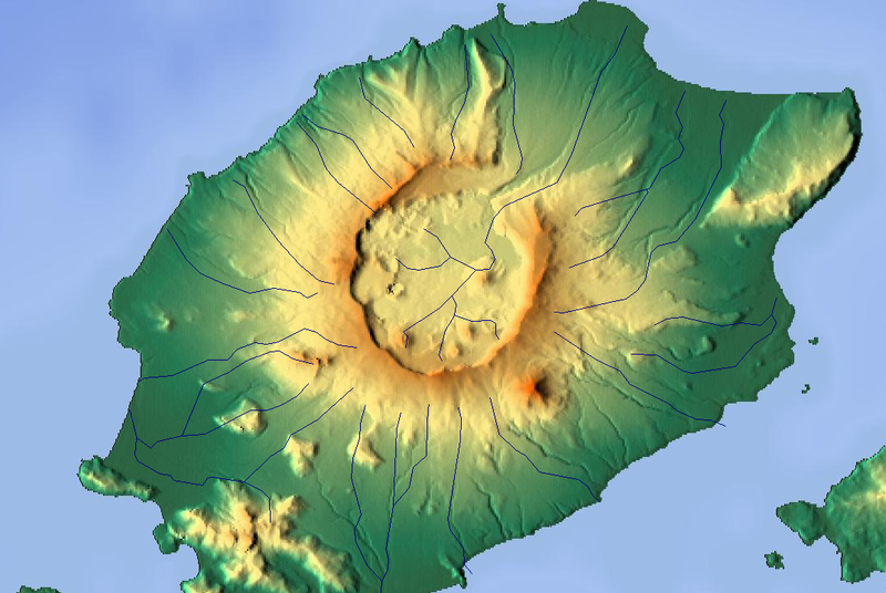
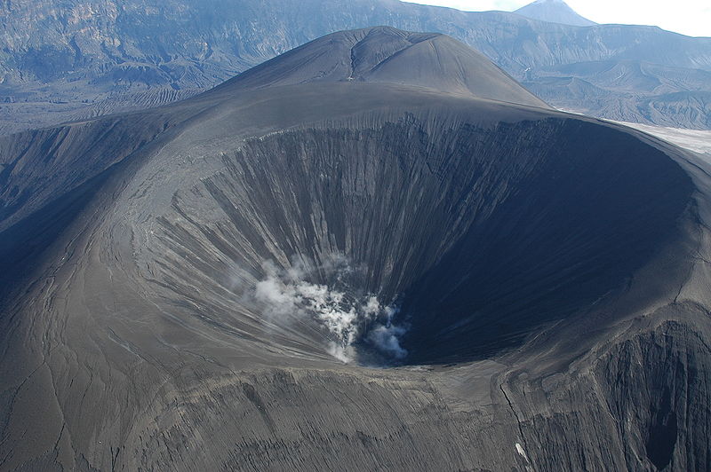
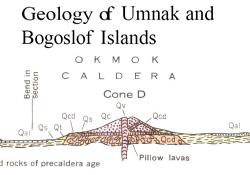
Okmok Caledra. Mount Okmok, Shield volcano Complex with nested Caldera, is the highest point on the rim of Okmok on the northeastern part of Umnak Island. This 9.3 km wide circular caldera truncates the top of a large shield volcano. A crater lake once filled much of the caldera to a depth of over 150 m, but the lake ultimately drained through a notch eroded in the northeast rim. The prehistoric lake attained a maximum depth of about 150 m and the upper surface reached an elevation of about 475 m , at which point it overtopped the low point of the caldera rim. Small, shallow remnants of the lake remained north of Cone D at an altitude of about 370 m: a small shallow lake located between the caldera rim and Cone D; a smaller lake (named Cone B Lake) farther north near the caldera''s gate. After the 2008 eruption, the hydrogeology of the caldera was greatly changed with five separate sizable lakes now emplaced. In addition to the caldera lakes, Cone A, Cone E, Cone G and the new 2008 vent on Cone D contain small crater lakes The last major eruptions of Okmokwith an estimated VEI strength of 6occurred 8,300 and 2,400 years Before Present.Following the formation of the caldera, numerous satellite cones and lava domes have formed on the flanks of the volcano. They include Mount Tulik (1,253 m), Mount Idak (585 m), and Jag Peak. Mount Tulik erupted in 1936. http://en.wikipedia.org/wiki/Mount_Okmok |
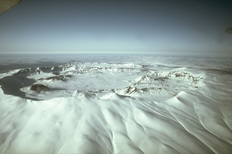
Aerial view looking across Okmok Caldera, elevatiom 1073 m. The Okmok caldera formed during catastrophic eruptions 12,000 and 2,000 years ago. There are about a dozen cones within the modern caldera that formed in the last 2000 years, and the most recent eruptive activity occurred in 1945, 1958 and 1997. One violent eruption of Okmok in 1817 produced many feet of ash and "scoria" rock debris on the northeastern caldera rim, as well as ash fall on Unalaska Island and floods that buried an Aleut village at Cape Tanak on the northeast Bering Sea Coast of Umnak Island |
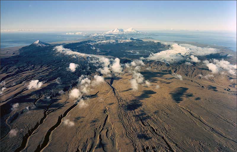
Scattered clouds cast shadows on the gently sloping sides of the Okmok volcano. The snow covered rim of the large Okmok caldera is also clearly visible. Photo: AeroMap -http://www.volcano-explorer.alaska.edu/46/airphoto/okmok-1.html |
In 2001, AVO geologists identified volcanic layers (right) formed by the explosive interaction of water and erupting magma. The deposits shown in the photograph are located atop Cone C, one of several prominent vents within Okmok''s caldera. Geologists also found evidence for the interaction between lava and ice in the caldera during past eruptions. Work this summer will focus more on these deposits |
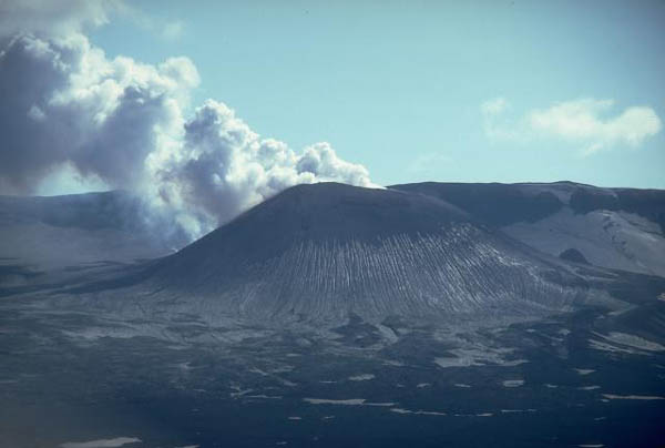
This eruption of Cone A in Okmok Volcano shows volcanic ash and lava flows - http://www.volcano-explorer.alaska.edu/46/airphoto/okmok-2.html |
Vents from Cone B viewing from the rim of Okmok caldera. Photo courtesy of Tina Neal, USGSFrom Miller and others (1998): "Okmok Volcano occupies most of northeastern Umnak Island. The volcano, built on a base of Tertiary volcanic rocks, consists of three rock series: older flows and pyroclastic beds of a pre-caldera shield complex; pyroclastic deposits of two major caldera-forming eruptions; and a post-caldera field of small cones and lava flows that includes historically active vents within the caldera (Byers, 1959). "Construction of the pre-caldera volcano began in late Tertiary or early Quaternary time. Two whole-rock K-Ar analyses of a sample of basaltic lava are 1.7 and 2.1 +/- .2 m.y. (Bingham and Stone, 1973). Basaltic flows and pyroclastics compose most of the older rocks (unit Qbm); flows are more voluminous than pyroclastic deposits (see Byers, 1959, plate 41). Vent agglomerate is exposed in the walls of the younger caldera and tuffs and tuff-breccias occur further down the flanks. Flows and pyroclastic beds dip radially from the caldera at less than 5 degrees in most sectors, except for local steepening and reversal of dips at former vents. Such radial dips suggest that the older complex was a central volcano with parasitic vents. Domes and plugs of andesite and rhyolitic composition and basaltic lava flows (Byers, 1959, p. 312) mark minor vents that were active before caldera formation; these rocks are only slightly modified by erosion and are presumably early post-glacial in age. "Catastrophic pyroclastic eruptions resulted in the formation of 2 overlapping calderas (Byers, 1959, p. 274). The deposits, referred to as the Okmok Volcanics (Byers, 1959, p. 314), are mainly thick, non-sorted agglomerate at the caldera rim overlain by ash-flow tuffs, and airfall ash and pumice that cover the flanks of the volcano to the shoreline (unit Qov). Two arcuate ridges located about 1.5 km north and east of the main topographic basin are the remnants of the older caldera, which formed about 8200 years ago (Black, 1975). The topographic basin of the younger caldera is about 9.5 km in diameter; the maximum elevation of the rim is about 1070 m and the mean elevation of the floor, exclusive of areas underlain by post-caldera volcanic rocks, is about 370 m. The occurrence of 2 major ash-flow sheets, separated by a basalt flow and erosional unconformity, supports the two caldera-forming eruptions (Miller and Smith, 1975). Miller and Smith (1987) have reported a maximum C14 age of 2400 +/- 200 yr for the second and younger caldera-forming eruption. "Numerous small flows, plugs, and cinder cones on the flanks of Okmok Volcano are interbedded with or overlie the upper pars of the Okmok Volcanics (unit Qyv). Within the caldera, the oldest post-caldera deposits are brecciated pillow lavas and pyroclastic rocks that were deposited in a caldera lake. The lake attained a maximum depth of about 150 m and the upper surface reached an elevation of about 475 m, at which point it overtopped the low point of the caldera rim. A small shallow lake located near the outlet of the caldera is all that remains today. Three dissected tuff cones may have been produced by eruptions beneath the former caldera lake. Other cinder cones occur atop pillow lavas; such cones apparently breached the surface of the former lake. Cinder cones and associated lava flows that are younger than the caldera lake are identified by structures and textures characteristic of subaerial eruption. The documented eruption of 1945 occurred at a cinder cone near the southwest caldera wall (Byers, 1959; Robinson, 1948); this cone may have been the site of all historical activity of Okmok volcano. Hot springs and fumaroles occur both within Okmok caldera and at Hot Springs cove, 20 km to the southwest." http://www.avo.alaska.edu/volcanoes/volcinfo.php?volcname=Okmok |
Mount Okmok Caldera Volcano emitting steam in 2002 |
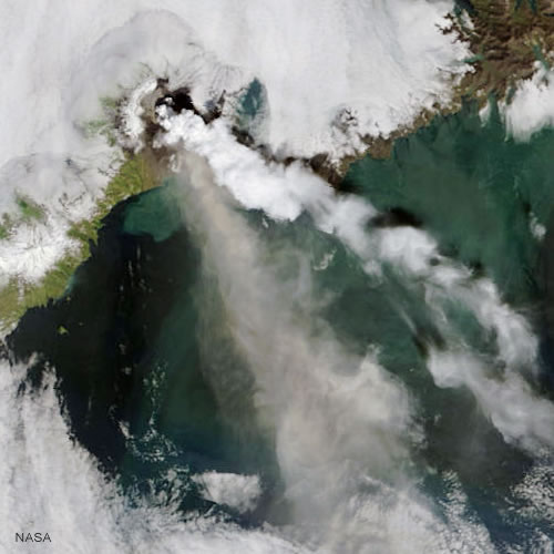
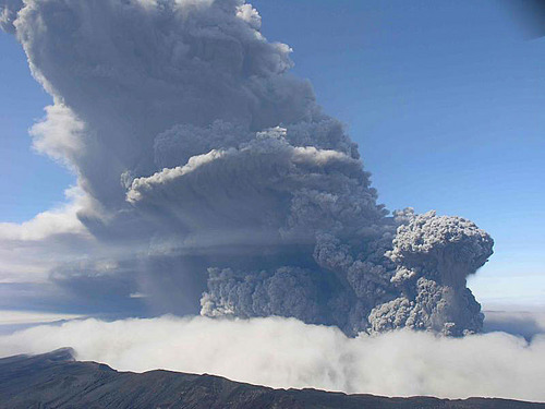
On Saturday, July 12, 2008, Okmok Caldera exploded without warning, sending a plume of ash to 15,000 m into the air.During the following five and a half days of nearly continuous eruption, residents of Nikolski (70 km southwest) were stranded for periods of up to three weeks; Unalaska (105 km northeast) was repeatedly dusted with ash and flights into and out of this major fishing hub were frequently disrupted; floating rafts of scoria and high visibility prompted the Coast Guard to close Umnak Pass to marine traffic; and the Bering Pacific cattle ranch on the flanks of Okmok was periodically evacuated, once during noon-time darkness caused by heavy ash fall. The eruption ended in August 2008. It had a VEI of 4, giving it a rating of "cataclysmic." No lava flow was reported in this eruption, though the volcano has issued flows in the past. The eruption took place at a new vent in the northeast part of the caldera, creating a roughly 270m high cone, dramatically altering caldera hydrology, and discharging huge lahars, or volcanic mudflows, running from the caldera to the coast. In contrast, all 20th century eruptions have been from a cone near the southern rim of the caldera. The 2008 eruption was by far the largest eruption at Okmok since at least the early 13th century.The volcano also erupted in February 1997 and produced lava splash and ash clouds to 9,000 metres. http://en.wikipedia.org/wiki/Mount_Okmok |
The Okmok volcano (pictured above) erupted in July in the Aleutians launching dust into the atmosphere. Dust and gas from this eruption and those of the Cleveland and Kasatochi volcanoes have been responsible for our more intense twilight colors. Photo: Jessica Larson, AVO/UAF-GI This abundance of volcanic aerosols gives the setting sun new material for flaunting its colors, like a kid with a new set of markers and fresh pad of paper. In addition to color, Ive also noticed subtle, grey bands and streaks of dust low in the west after sunset. While the intensity of the twilight hues doesnt come close to those we experienced during the 1991 Mt. Pinatubo eruption, that could change depending on further activity and upper level winds.- http://astrobob.areavoices.com/2008/08/30/volcanic-dust-paints-duluths-sunsets/ |
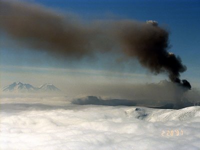
Aerial view of 1997 eruption cloud from Okmok volcano, Alaska |
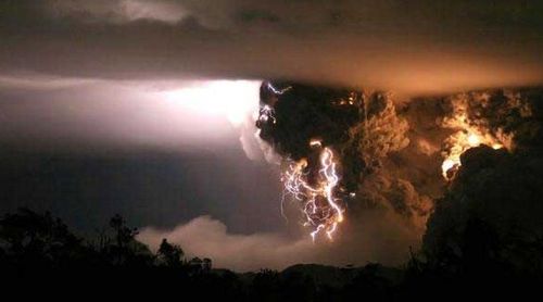
d In the late morning of 12 July 2008, the Alaska Volcano Observatory (AVO) received an unexpected call from the U.S. Coast Guard, reporting an explosive volcanic eruption in the central Aleutians in the vicinity of Okmok volcano, a relatively young 2000-year-old caldera. The Coast Guard had received an emergency call requesting assistance from a family living at a cattle ranch on the flanks of the volcano, who reported loud thunder, lightning, and noontime darkness due to ashfall. AVO staff immediately confirmed the report by observing a strong eruption signal recorded on the Okmok seismic network and the presence of a large dark ash cloud above Okmok in satellite imagery. Within 5 minutes of the call, AVO declared the volcano at aviation code red, signifying that a highly explosive, ash-rich eruption was under way.The seismometers were actually picking up lightning strikes. 20 to 30 minutes of lighting. At the moment the eruption started, there were these sparks of lightning coming from the vent of Redoubt that only lasted 1 to 2 millisecondsthis was a different kind of lighting. http://www.dailygalaxy.com/my_weblog/2010/01/volcanic-lightning-discovered.html |
The New Cone at Okmok Volcano (Photo by C. Neal, Alaska Volcano Observatory) |
Okmok Volcano, USA Steam rises in December 1980 from a cinder cone Steam rises in December 1980 from a cinder cone in Alaska''s Okmok caldera. |
hairstyles funky, Okmok Volcano Eruption |
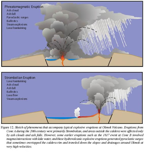
Okmok eruption style - Cartoon showing hypothetical phreatomagmatic and Strombolian style eruptions within Okmok caldera by Jessica Larsen AVO/ADGGS. http://geology.com/events/okmok-volcano/ |
|
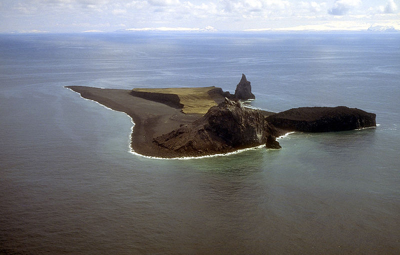
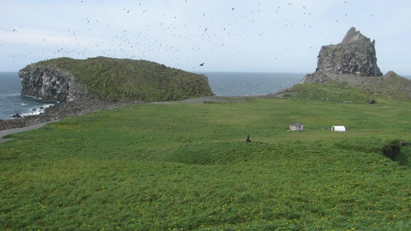
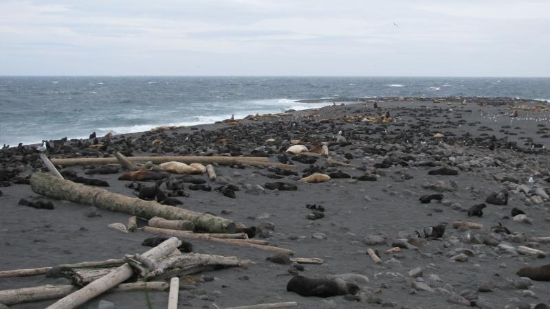
Aerial view, looking south, of Bogoslof Island.Bogoslof Island or Agasagook Island is the summit of a largely submarine stratovolcano located in the Bering Sea in the U.S. state of Alaska, 50 km behind the main Aleutian volcanic arc. It has a land area of 0.70 km2 and is unpopulated. The peak elevation of the island is 150 m. It last erupted in 1992. It is 1.76 km long and 540 m wide.The first known emergence of the island above sea level was recorded during an underwater eruption in 1796. Since then, parts of the island have been successively added and eroded.In 1909 President Theodore Roosevelt designated Bogoslof and neighboring Fire Island a sanctuary for sea lions and nesting marine birds. Together, as the Bogoslof Wilderness, they are now part of the Aleutian Islands unit of Alaska Maritime National Wildlife Refuge. In November 1967, the island was designated a National Natural Landmark by the National Park Service. The islands were added to the National Wilderness Preservation System in 1970. A fur seal colony on Bogoslof Island. http://en.wikipedia.org/wiki/Bogoslof_Island |
|
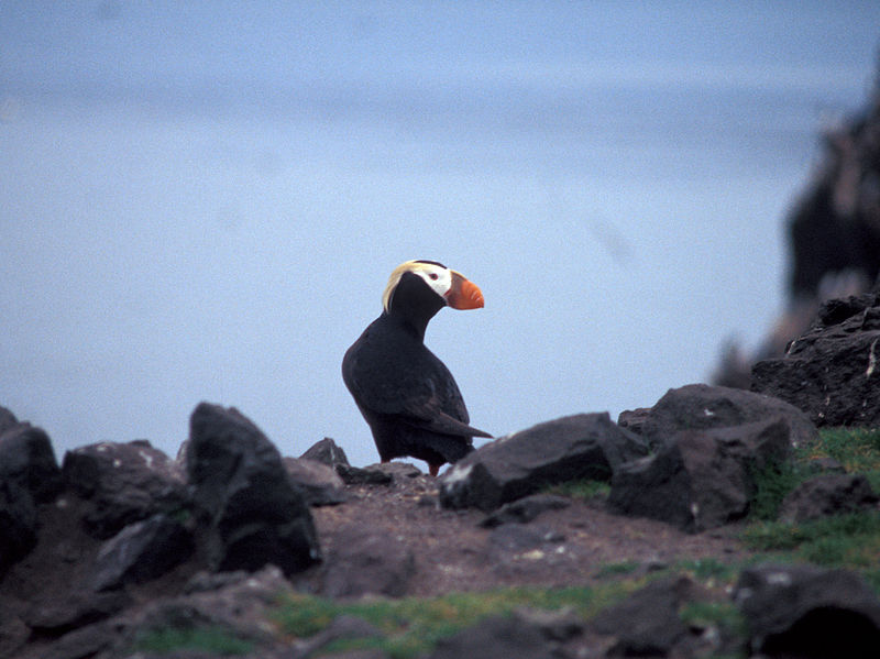
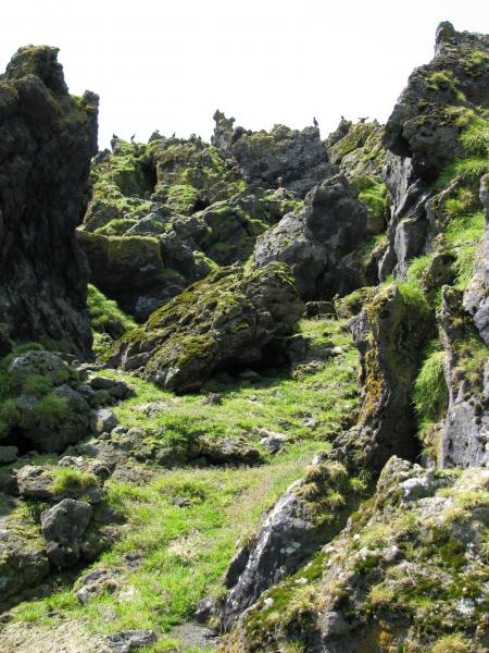
A Tufted Puffin on Bogoslof Island |
Puffins and murres nest on lava dome on Bogoslof Island |
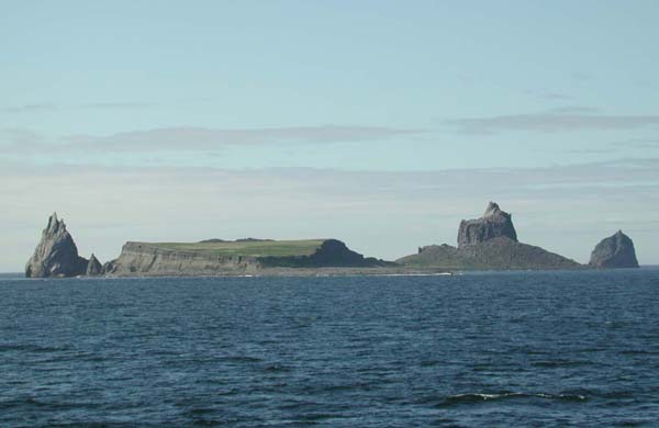
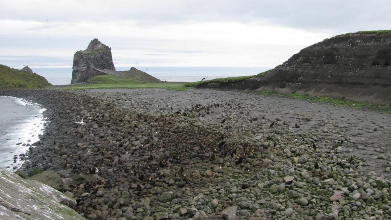
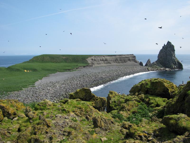
New dome and lava dome from the center of the island. (Bogoslof island.). From Miller and others (1998): "Bogoslof Island is the largest of a cluster of small, low lying islands that comprise the emergent summit of a large submarine stratovolcano that rises more than 1500 m above the Bering Sea floor (Byers, 1959, plate 39). The volcano appears to be a back-arc feature as it occurs well behind the volcanic front of the main Aleutian arc. The island has undergone dramatic changes in size and shape during historical time, an evolution that has been unusually well observed and recorded for such an isolated volcano. "The island is presently shaped like an irregular isosceles triangle about 2.0 km long and 0.75 km wide covering an area of 0.75 square kilometers. Castle Rock, a steep, twin-spired pinnacle along the southwest side of the island is the eroded remnant of a dome extruded in 1796. Vent agglomerate produced during the explosive phase of that eruption lies in fault contact with the dome material and is best exposed in the southeast part of the sea cliff below Castle Rock. "A blanket of basaltic agglomerate and ash is plastered against the steep north and east flanks of Castle Rock and extends north and east as a broad terrace. This material is interpreted by Byers (1959) to have been deposited primarily during the 1926 eruption but may also be from earlier Bogoslof eruptions. The tephra layer, along with a basaltic dome extruded in early 1927, comprises most of the area of the island, which is steadily being reduced by marine erosion. The 1927 dome is a rounded knob more than 40 m high and 305 m in diameter on the northwest coast, and fronts an arcuate salt water lagoon to the east. Cobble-boulder beaches fringe the island''s north and southeast shores and a sand beach extends along the eastern margin. "About 610 m northwest of Bogoslof lies Fire Island, a tiny flat-topped stack resembling a lighthouse. The island is the remnant of a dome extruded in 1883. Domes produced during other episodes of Bogoslof volcanism have been completely destroyed through subsequent explosive eruption and marine erosion http://www.avo.alaska.edu/volcanoes/volcinfo.php?volcname=Bogoslof |
The new dome, Bogoslof Island - http://www.avo.alaska.edu/volcanoes/volcinfo.php?volcname=Bogoslof |
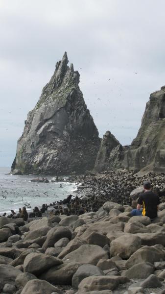
Castle Rock on Bogoslof Island. Castle Rock is the eroded remnant of a dome extruded in 1796 |
View of Castle Rock from the spit on Bogoslof Island. Castle Rock is the eroded remnant of a dome extruded in 1796 - http://www.avo.alaska.edu/volcanoes/volcinfo.php?volcname=Bogoslof |
The spit, A fur seal colony on Bogoslof Island.http://www.avo.alaska.edu/volcanoes/volcinfo.php?volcname=Bogoslof |
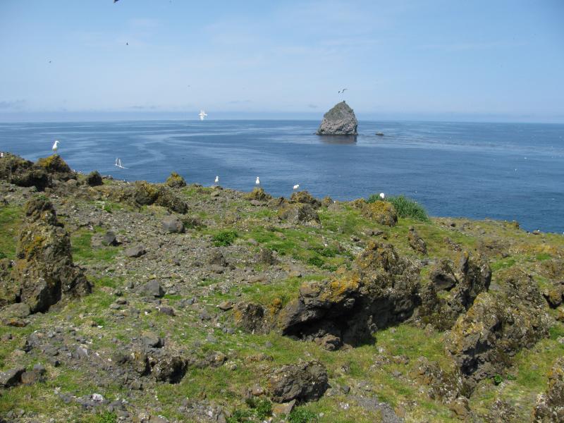
View of Fire Island, to the northwest of Bogoslof Island. Fire Island is the remnant of a dome extruded in 1883 |
http://en.wikipedia.org/wiki/Ignimbrite
washington highest peaks http://www.rhinoclimbs.com/Top100x400P.11-20.htm
http://volcanoes.usgs.gov/activity/methods/insar/fact_sheet_figures.html california !!! monitoring ground deformation from space
next
Katmai Volcanoes
Art: Sailing Ship Near Makushin Volcano on Unalaska Island in the Aleutians, 1870
